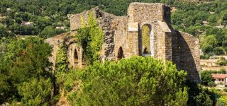
Exploring the Massif des Maures mountains
Hiking through chestnut country
The massif of the Moors covers a large part of the Var and offers many forests of chestnut pines ... that you can discover hiking. It extends from the coast to the Var hinterland. Here are the most famous hiking trails of the Moors:
- The coastal path from Fort Brégançon to Argentières (18 km round trip, 6 hours, yellow signposting, 300 m vertical drop, easy level, accessible to children from 8 years old)
- The Gaoutabry dolmen (7.4 km round trip, 2 hours, blue markup, 308 m difference in altitude, departure from the free parking of Notre-Dame des Maures)
- The Rouay de la Cabre (9.2 km round trip, 2h30, blue signposting, 349 m vertical drop, easy level, stroll among the vineyards and olive trees)
- The Vallat - la Derroucade (19.3 km round trip, 5 hours, 672 m vertical drop, beautiful walk that offers the opportunity to admire the chestnut and pistachio trees)
- The tour of La Londe between land and sea (9.4 km roundtrip, 3 hours, blue markup, 10 m vertical drop, very nice walk accessible to cyclists and riders)
- The equestrian track (15 km loop, green and white signposting, 75 to 400 m vertical drop, new circuit that starts from the Saint-Honoré tower area)
- Notre Dame des Anges Sanctuary (12.5 km loop, 5 hours, 578 m vertical drop, medium level departure from Pignans)
- The visit of Fort Freinet dating from the Middle Ages from La Garde Freinet
- The top of the Hermitage from the Chartreuse de la Verne (8,58 km loop, 3h15, 315 m vertical drop, easy level, departure from Collobrières)
- The Menhirs of Lambert departing from the Croix d'Anselmes (loop of 11.52 km, 3h40, 170 m of altitude difference, medium level, departure from Collobrières)
- The white rocks from La Garde Freinet
- The Rocher de Roquebrune (6.5 km, 2h30, 296 m vertical drop, difficult level, departure from Roquebrune-sur-Argens)
The massif of the Moors is also discovered on horseback (equestrian centers in Grimaud, La Londe, Crau, Saint Aygulf) or mountain bike.
